Evacuations: L.A. County has issued evacuation orders for areas around Castaic Lake. This zone roughly encompasses the area east of Lake Piru and the Ventura County border, west of Bouquet Canyon Road, south of Sandberg and north of Castaic Junction.Ventura County issued an evacuation order for an area east of Lake Piru and west of Interstate 5.Most updated evacuation instructions can be found here and here.
Road Closures included Ridge Route Road at Lake Hughes Road, Ridge Route Road at Templin Highway, Lake Hughes Road at Pine Canyon Road, Dry Gulch Road at San Francisquito Canyon Motorway; the Parker Road and Lake Hughes Road off-ramps were closed on the northbound 5 Freeway.Interstate 5 was closed in both directions along its Grapevine section earlier in the day, but the roadway reopened Wednesday evening.More road closure information can be found
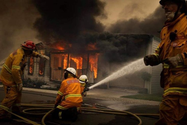
Palisades fire
Containment: The fire was 70% contained as of Wednesday evening. It has burned more than 23,400 acres.
Damage: Officials have confirmed, so far, 6,662 structures have been destroyed and 890 damaged.
Lives lost: Officials have confirmed that 11 people are dead from the Palisades fire.
Evacuations: Some mandatory evacuation zones have been reopened to residents.
Eaton fire
It has burned more than 14,000 acres.
Damage: Officials have so far tallied 9,418 structures destroyed and 1,073 damaged.
Lives lost: Officials have confirmed 17 are dead from the Eaton fire.
Evacuations: Evacuation orders have been lifted for some portions of south Altadena. And “soft closures” were in place in other areas within the mandatory evacuation area including south of East Altadena Drive, north of West Harriet Street and East Mendocino Street, west of North Allen Street and east of Lincoln Avenue.